AI is transforming climate science by analyzing large datasets for pattern recognition, which is quicker and more accurate in forecasting extreme weather events. AI also reduces the time to process complex simulations involving scientific calculations such as physics and interactions with our physical environment.
Predictive Models (or Climate Models) are complex computer programs that use math and physics to simulate how the Earth’s systems—like the atmosphere, oceans, and ice sheets—will react to different levels of greenhouse gases.
Instead of guessing, these models create « scenarios » based on how much carbon we emit. Using these interactive predictive tools, we can see many possible futures by changing small « what if » variables.
Follow the links to the interactive prediction tools and predictive graphs to see how different sea level rise projections will affect coastal communities.
Climate Central Loss of Land
Climate Central
An interactive map showing areas threatened by sea level rise and coastal flooding. Combining the most advanced global model of coastal elevations with the latest projections for future flood levels.
Nasa Sea Level Change
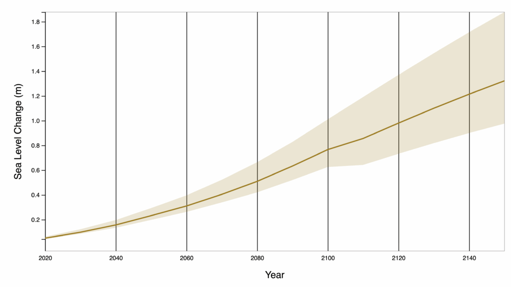
NASA & IPCC
View both global and regional sea level projections from 2020 to 2150, along with how these projections differ depending on future scenario or warming level.
NOAA Sea Level Height
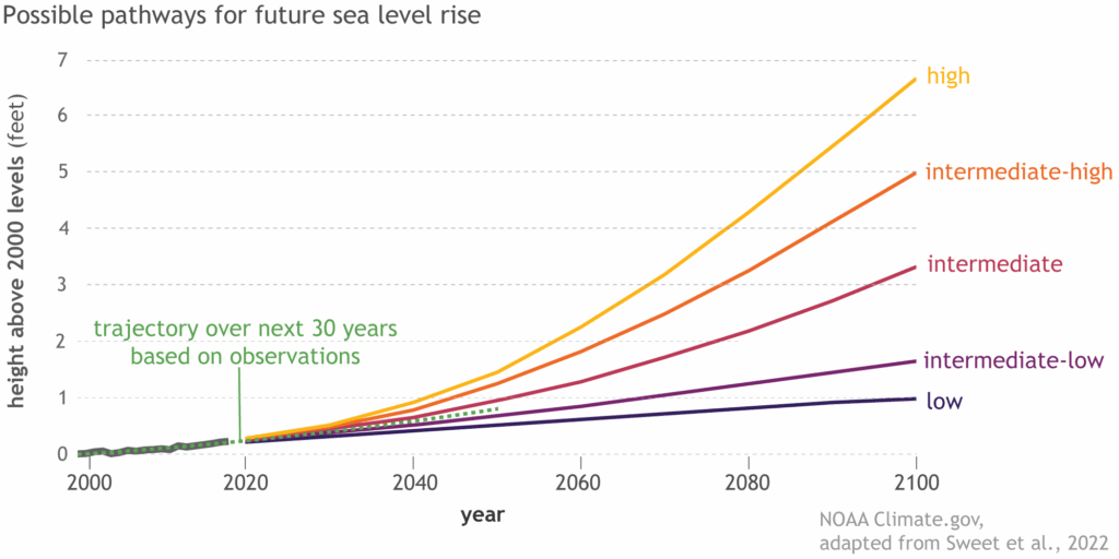
NOAA
Photo simulations of how future flooding might impact local landmarks are also provided, as well as data related to water depth, connectivity, flood frequency, socio-economic vulnerability, wetland loss and migration, and mapping confidence.